
")
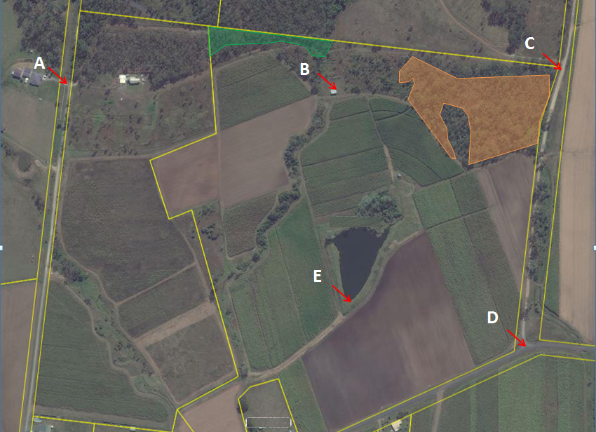
A PMAV is a property-scale map that shows the ground-truthed type, size and location of vegetation communities on a property. Copies of State Government regulated vegitation maps are available free of charge. However, prior to looking at development in an area containing regulated vegetation, it is important to have the extent and type of the vegetation ground truthed by a qualified ecologist and then amended if necessary. This can often allow for an increase in the size and number of lots in a development, and decrease the cost of any vegetation offsets. A PMAV can also ‘lock in’ low regrowth as non-remnant ‘Category X’, allowing it to be cleared in the future, if necessary.
Core Services
Key Industries